Neighbor Went After the 5.42 Acres and the Deed They’d Signed Over to Their Son — Then the Court Quieted Title in the Family’s Favor
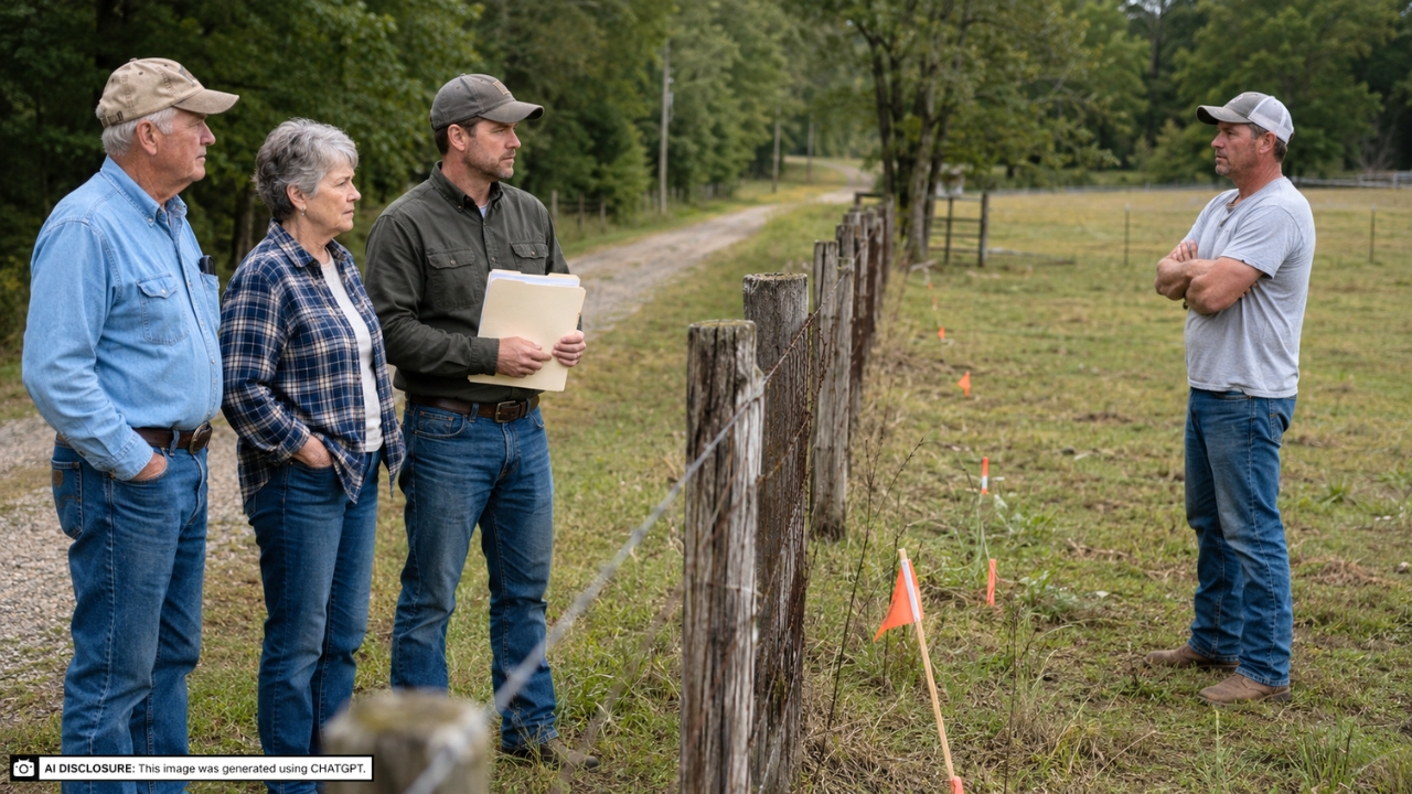
Photo credit: AI-generated image created using ChatGPT. Illustrative only.
Land disputes have a way of turning neighbors into courtroom regulars, even when both sides swear they’re just protecting what’s “theirs.” In rural places especially, a fence line and an old road can feel more real than anything written on paper, right up until a surveyor shows up with flags and a different opinion.
That’s the heart of an Arkansas case where a man claimed a 5.42-acre strip fell inside his forty-acre deed, while the family to the south said the fence and roadway had been treated as the boundary for decades. The Arkansas Court of Appeals affirmed the trial court’s decision to quiet title in the family’s favor, rejecting the neighbor’s attempt to take the acreage and also rejecting his effort to undo a deed the parents had signed over to their son. The opinion is laid out in the source material, and it reads like a cautionary tale about assumptions, silence, and how long-standing habits can harden into legal rights.
The case is Jerry Arter v. Naomi and Francis Pike, and their son John Pike. The decision came down April 1, 2026, from the Arkansas Court of Appeals, after a bench trial in Searcy County Circuit Court the year before.
Two deeds, two forty-acre tracts, and one messy strip in between
Both sides owned “quarter quarter” tracts of roughly forty acres in Section 6, Township 13 North, Range 17 West. Arter bought his property in 2001, and the Pikes bought theirs in 2005. Arter’s land sits north of the Pikes’ land, and the fight centered on a 5.42-acre tract near the south edge of Arter’s property and the north edge of the Pikes’ property.
A fence and a road run east to west in that area, with the fence north of the road. The Pikes’ deed also referenced an easement: a 16-foot-wide road and utility easement over an existing roadbed running west from County Road No. 5 (also called Lick Fork Road) “along the North boundary” of their tract. That deed language mattered because it fit with how the Pikes believed the property had been treated on the ground.
Things got hot after Arter had a survey done in April 2019. His survey showed the disputed 5.42 acres south of his fence still fell inside his deeded forty acres, and the Pikes’ own survey later that year showed the same. In other words: the surveys pointed one way, and the long-standing use and visible markers arguably pointed another.
How it ended up in court
In May 2023, the Pikes filed a petition to quiet title, alleging boundary by acquiescence and adverse possession. Their position was basically that the fence and roadway easement had long served as the “real” northern boundary of their property, and that everyone had acted that way for years. They also alleged the parties maintained their respective sides of the fence, and they claimed Arter trespassed and removed timber from what they considered their land.
Arter answered and counterclaimed. He asked the court to quiet title in him and to set aside a quitclaim deed the Pikes had executed in April 2023 to their son John. Arter argued that deed, which included a legal description of the disputed tract, created a cloud on his title.
A bench trial was held September 26, 2024. The circuit court ultimately quieted title to the 5.42 acres in favor of the Pikes and their son, based on boundary by acquiescence, and it denied Arter’s counterclaim. Arter appealed, and the Court of Appeals affirmed.
The surveys agreed on the line, but the law didn’t stop there
This is the part that surprises people who’ve never watched a boundary fight up close. You can have a clean survey that places the legal line one place, and still lose land if the courts decide a different boundary was established over time by the way neighbors lived with each other.
The Pikes’ surveyor, Nathan Dearyan, testified that the disputed tract lies within Arter’s title, not the Pikes’ title. He also pointed out that the Pikes’ deed referenced a roadway easement, and he said that kind of reservation had been in the chain of title since around 1920. He testified aerial photos showed the road in about the same place since at least 1980, though he said it could have moved by as much as forty feet, and he noted the road was “greatly” improved and straighter after about 1997.
Even with that, the courts weren’t limited to “what the survey says.” Arkansas law recognizes that boundaries can be established by acquiescence, and once that happens, it can control even when it conflicts with an accurate survey.
What “boundary by acquiescence” looked like in real life
Boundary by acquiescence isn’t about one big handshake deal. It can be quiet, almost boring, built on years of behavior that implies an agreement: a fence line, a road, a ditch, a lane—some visible marker both sides treat as the divider long enough that it becomes the divider.
The Pikes testified they believed the fence was the northern boundary and that they treated it that way after buying the property in 2005. Francis Pike said the road and fence existed when he looked at the place years before buying it, and he believed he bought “forty acres, including the road to the fence.” He described maintaining the area by mowing up to the fence to prevent fire spread, raking rocks back onto the road, and putting in multiple firebreaks. He also testified a semi-trailer sat just over the edge of the disputed tract, and he maintained a compost pile there.
Naomi Pike backed up her husband’s description of their understanding and use. She also testified that debris from a predecessor’s burned-down house had been placed on the disputed tract, and she said the fence had been in essentially the same location since they bought the property.
Neighbors and long memories carried weight
Courts lean hard on credibility in boundary cases, because you’re often dealing with things no document can fully capture—what people did, what they assumed, what they tolerated, and what they fought about. Here, multiple witnesses gave testimony about the road and fence being in the same place for decades.
Harold Hendrix, who owned land to the west, testified he’d known the road since his childhood and that he had a 16-foot easement across the north boundary of the property that was later owned by the Pikes. He described a prior lawsuit where the Browns (predecessors to the Pikes) were ordered to remove a gate that blocked access to the easement. Hendrix said he believed the road and fence were treated as the boundary line and that “everybody” treated it that way.
Doug Weaver, who said he’d been familiar with the area for sixty years, testified the road and fence had been in the same location that whole time. He said the Pikes owned property south of the road and Arter owned property north of the road, and he testified he’d seen the Pikes in the disputed area but never saw Arter south of the road. Another witness, David Mason, testified similarly—he’d been on the road many times, recalled the earlier easement lawsuit, and said he’d seen the Pikes and their predecessors using the area.
On the other side, Arter testified he bought forty acres in 2001, paid taxes on it ever since, and used it as pasture. He testified he hired a bulldozer operator, Jeff Magness, to build or improve the existing road around 2002 or 2003, saying it had been only a “wagon road” before. He also said he never spoke with the Pikes about the fence being the boundary and that it isn’t uncommon for fences to be off the true line.
Why Arter’s challenge to the son’s deed didn’t work
Part of Arter’s counterclaim was aimed at the Pikes’ April 2023 quitclaim deed to their son John. He wanted it set aside as a cloud on his title, since it included a legal description of the disputed tract. In plain terms, he was saying, “They deeded away land they didn’t own, and it messes with my ownership.”
But once the circuit court found boundary by acquiescence and quieted title in the Pikes’ favor, the foundation for Arter’s argument collapsed. If the Pikes were the rightful owners of the disputed strip under the boundary the court recognized, then conveying it to their son wasn’t an improper cloud on Arter’s title. The trial court denied Arter’s counterclaim, and the Court of Appeals affirmed that result.
The appeals court: the trial judge didn’t clearly get it wrong
On appeal, Arter argued the evidence didn’t show mutual intent to recognize the fence as the boundary, and he emphasized that both surveys placed the tract within his deed. The Court of Appeals agreed with the legal principle that you need mutual recognition, not just one person’s belief, but it also pointed out that silent acquiescence over years can be enough. The appellate court deferred to the trial judge’s ability to weigh testimony and credibility, especially where several witnesses supported the fence-and-road boundary as the accepted line.
The court affirmed the finding that boundary by acquiescence had been established. It also affirmed the denial of Arter’s counterclaim, leaving title to the 5.42 acres quieted in favor of Naomi and Francis Pike and their son John.
There’s a sober lesson here, even if nobody wants to hear it when they’re angry and sure they’re right. If a fence and an old road have been treated like the line long enough, and you don’t speak up or get clarity early, a court can decide that’s the line—survey or not. Property is stewardship, not just paperwork, and ignoring small disputes for years can turn into the kind of fight that costs far more than the acres ever did.
Read more from Thrive Girly:
- Mother-in-Law Expected to Sleep Over After Every Visit — Then the Mom Said Overnight Stays Were No Longer an Option
- Relatives Showed Up to the Wedding Without Being Invited — Then the Couple Refused to Find Them Seats
- Grandma Buckled the Baby Into Her Car and Left Without Telling Anyone — Then the Mom Made Sure It Never Happened Again